Ntchisi District (Ntchisi District)
Ntchisi is a district in the Central Region of Malawi. The district covers an area of 1,655 km.² and has a population of 317,069. The capital is Ntchisi.
Ntchisi District has a population density of about 128 people per square kilometer. The province is all between 1,300 and 1,700 meters above sea level. About half (north and west) is hilly, while the other half (south and east) is generally flat. The average temperature is about 20 degrees Celsius.
Ntchisi District has a population density of about 128 people per square kilometer. The province is all between 1,300 and 1,700 meters above sea level. About half (north and west) is hilly, while the other half (south and east) is generally flat. The average temperature is about 20 degrees Celsius.
Map - Ntchisi District (Ntchisi District)
Map


Country - Malawi
 |
 |
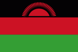
| Flag of Malawi | |
In 1891, the area was colonised by the British and became a protectorate of the United Kingdom known as Nyasaland. In 1953, it became a protectorate within the semi-independent Federation of Rhodesia and Nyasaland. The Federation was dissolved in 1963. In 1964, the protectorate was ended: Nyasaland became an independent country under Queen Elizabeth II, and was renamed Malawi. Two years later it became a republic. It gained full independence from the United Kingdom, and by 1970 had become a totalitarian one-party state under the presidency of Hastings Banda, who remained in this role until 1994. Malawi has a democratic, multi-party republic headed by an elected president. Lazarus Chakwera of the Malawi Congress Party led the Tonse Alliance grouping of nine political parties and won the court-mandated Presidential Election rerun held on 23 June 2020 after the May 2019 Presidential Election was annulled due to electoral irregularities. The country's military, the Malawian Defence Force, includes an army, a navy, and an air wing. Malawi's foreign policy is pro-Western. It maintains positive diplomatic relations with most countries, and participates in several international organisations, including the United Nations, the Commonwealth of Nations, the Southern African Development Community (SADC), the Common Market for Eastern and Southern Africa (COMESA), and the African Union (AU).
Currency / Language
| ISO | Currency | Symbol | Significant figures |
|---|---|---|---|
| MWK | Malawian kwacha | MK | 2 |
| ISO | Language |
|---|---|
| NY | Chichewa language |